
Benson Creek
Ontario, Canada
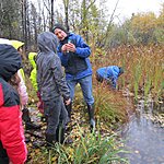
Test on west side of Hwy 624 at culvert where water from Benson Creek enters under the roadway then flows into Larder Lake.
Location created by
Don Ross
- Group: County Sustainability Group
- Lat: 48.0496854
- Lng: -79.7037506
- Waterbody Type: Creek
- Timezone: America/Toronto
Latest photos


There are currently no issues at this location.