
Welland River Branch
Ontario, Canada
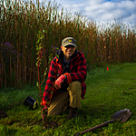
Welland River Branch south/upstream of where it enters the Welland River. Slow moving water. Area has farming, ranching and homes along the Welland River.
Sampling off bridge is not recommended -- unsafe due to fast moving vehicles along Regional Rd 27 (80km/h+). Park slightly east of bridge and walk down embankment to waters edge on south east side of bridge to sample.
Location created by
Tom Liszt
- Group: Lake Erie Rangers : Lake Erie Rangers Monthly Monitoring
- Lat: 42.9668889
- Lng: -79.3578388
- Waterbody Type: Creek
- Timezone: America/Toronto
Latest photos


Welland River Branch : Welland River Branch
Observed on
2025-06-20
Smell of manure. Small horse ranch exists on east side of waterway.
Welland River Branch : Welland River Branch
Observed on
2025-05-20
Welland River Branch : Welland River Branch
Observed on
2025-04-24
Welland River Branch : Welland River Branch
Observed on
2025-03-31
Heavy rains over the past 2 days.
Welland River Branch : Welland River Branch
Observed on
2025-03-12
Welland River Branch : Welland River Branch
Observed on
2025-02-23
Welland River Branch completely frozen. Unable to sample.
Welland River Branch : Welland River Branch
Observed on
2025-01-26
99% ice coverage. Some surface melt along shoreline but sampling inaccessible.
Welland River Branch : Welland River Branch
Observed on
2024-12-28
40-50% ice coverage on Welland River Branch. Met Joe, friendly homeowner at 61574 Regional Rd 27...