
Welland River Branch
Ontario, Canada
Welland River Branch south/upstream of where it enters the Welland River. Slow moving water. Area has farming, ranching and homes along the Welland River.
Sampling off bridge is not recommended -- unsafe due to fast moving vehicles along Regional Rd 27 (80km/h+). Park slightly east of bridge and walk down embankment to waters edge on south east side of bridge to sample.
Location created by
Tom Liszt
- Group: Lake Erie Rangers : Lake Erie Rangers Monthly Monitoring
- Lat: 42.9668889
- Lng: -79.3578388
- Waterbody Type: Creek
- Timezone: America/Toronto
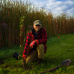
Latest photos


Smell of manure. Small horse ranch exists on east side of waterway.
Heavy rains over the past 2 days.
Welland River Branch completely frozen. Unable to sample.
99% ice coverage. Some surface melt along shoreline but sampling inaccessible.
40-50% ice coverage on Welland River Branch.
Met Joe, friendly homeowner at 61574 Regional Rd 27, Wainfleet ON L3B5N6. Advised him of our work and that he may see us collecting data moving forward.