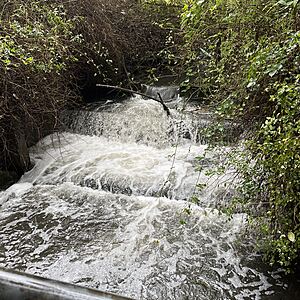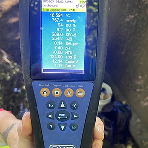
Wagg Creek at footbridge below sedimentation pond - WAG-M-03 Medium Priority
North Vancouver, British Columbia, Canada
WAG-M-03 WAG Creek at footbridge below the sedimentation pond at the fish ladder. CNV City Map CNV City Map -123.0777490, 49.32733712 Long and Lat, or UTM 494,351E, 5,463,848N. Identical to Salt Project site "Wagg Creek Fish Ladder and Pond at Mahon St". Merge data into this new location or archive old data?

Location created by
Paul Lhotka
- Site ID: WAG-M-03
- Lat: 49.3272058
- Lng: -123.0778384
- Waterbody Type: Creek
- Timezone: America/Vancouver
Latest photos
View all photosThere are currently no issues at this location.


