pH (0-14)
What's this?
6.8
Marina 200 : St. Lawrence River
Ontario, Canada

Observed by
Winter McDougall
- Observed on: Fri, 27 Sep 2024 13:06:00 -0400
- Testers Winter McDougall
-
Associated with:
River Institute : Community-based Water Monitoring - Lat: 45.013512
- Lng: -74.7192407
Observation report
See trends at this locationWater quality tests
Pending Quality Check from Water Rangers What's this?
Dissolved oxygen mg/L
What's this?
9.0
Secchi depth m
What's this?
bottom visible
Chlorine ppm
What's this?
0.0
Hardness mg/L
What's this?
50.0
Turbidity JTU
What's this?
0.0
Alkalinity mg/L
What's this?
50.0
Water depth m
What's this?
2.56
Conductivity μS/cm
What's this?
270.0
Air temperature °C
What's this?
20.0
Water temperature °C
What's this?
19.8
Wildlife

Plant
What's this?
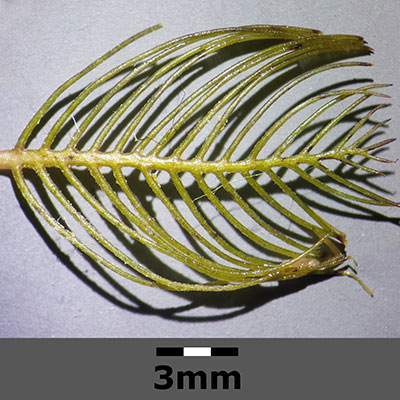
Invasive Species

Eurasian Milfoil
What's this?
Weather
Current weather What's this?
Weather in previous 24 hours What's this?
Latest photos
No photos uploaded.
Notes
water clarity and depth were measured on the left corner of the north pier facing the Canadian flag at approximately 45.01359, -74.718 via google maps or UTM 18T 522217 4984515
All other parameters measured at UTM 18T 522232 4984504 or to the left of the pier along the rocky shoreline
Plant species observed: apple tree, American Aster, Purple Aster, Eel grass, Golden rod, clover,
