St. Lawrence River
Ontario, Canada
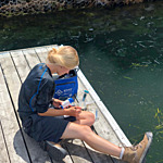
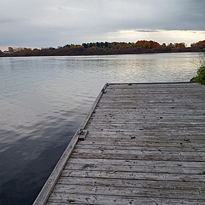
The sampling was done off the dock near the marina entrance with slow-moving water, lots of vegetation and small fish.

- Group: River Institute : Upper St. Lawrence River Volunteer Monitoring
- Lat: 45.013512
- Lng: -74.7192407
- Waterbody Type: River
- Timezone: America/Toronto
Latest photos
View all photoswater clarity and depth were measured on the left corner of the north pier facing the Canadian flag at approximately 45.01359, -74.718 via google maps or UTM 18T 522217 4984515
All other parameters measured at UTM 18T 522232 4984504 or to the left of the pier along the rocky shoreline
Plant species observed: apple tree, American Aster, Purple Aster, Eel grass, Golden rod, clover,
Many boats present and parked at the dock.
A boat approximately 5 m from the sample site left while taking the water sample for conductivity measurements. A very hot day with some haze.
A lot of human activity
Did not get the water clarity or depth - had to return to fix the secchi tape jam
Lots of curly leaf pondweed, sago, elodea, coontail.
Saw young largemouth bass, a catfish (brown bullhead?) and sunfish swimming around the dock.
Also saw freshwater sponge growing on the cement under the dock.


