Pearl River
Brandon, Mississippi, United States
Pearl River just downstream from the Ross Barnett Reservoir Spillway dam. East side of the Pearl just upstream from where Pelahatchie Creek enters.

- Group: Mississippi State University : Mississippi Water Stewards
- Lat: 32.3944936
- Lng: -90.0654244
- Waterbody Type: River
- Timezone: America/Chicago
Latest photos
View all photosRiver very low; 1 gate open good flow; a few egrets in trees; some herons on deadfall and bars; beautiful cooler morning; osprey on dead tree on West Bank
River very low; 1 gate open and not much flow; river flow also slow; a few herons and egrets downriver. Algae coating submerged rocks and clumps of brown and green algae in the water, floating near shore
River low. One gate open, a lot of egrets flying around and large group of them on west beach. Herons on bars.
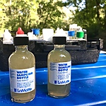
River very low; 1 gate open; herons and egrets on bars downriver and at dam; a few fishermen. Watery murky; algae slime covering underwater rocks. R-cards worked-see photo.
Included photos of R-cards-other coliforms are quite faint, no E. coli indicated. Air still. River low; many deadfalls and bars visible. A few fishermen. Two gates open. A few herons downriver.
River low-average;deadfall visible; hot still late afternoon; 3 gates open; several herons on deadfall
Concerned that R-cards showed nothing, not even faint dots. I checked this morning (about 12 hours later) and still showed nothing. Will check on getting new R-cards
Hot; still. 3 gates open; river depth below average; trees showing in river; a few egrets at dam; herons along river and one on beach. Very few fishermen
2 gates open and far east gate partially open; no birds, many fishermen
Average water level; 2 gates open; a few fishermen; a few egrets, herons
River up, but not too high; 2 gates wide open on spillway; herons and egrets as sun is coming up


