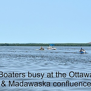
Mouth of Madawaska River
Arnprior, Ontario, Canada
Water is fairly fast moving along shore of town of Arnprior and running alongside town effluence pipe. Town pipe dumps contents into Ottawa approximately 300 meters from the north west land point. Town filtration centre, manicured land, boat launch (with gas pumps), town marina and walking path run along northwest side of river (above pipe line). A supervised town beach runs along the curve and shoreline on Ottawa River. Shoreline on south east side of River includes a mix of natural shoreline, docks, yacht club and housing. Some rocky areas but all well marked. Busy boating area.

- Group: Ottawa Riverkeeper : Riverwatch
- Lat: 45.4431247
- Lng: -76.3491762
- Waterbody Type: River
- Timezone: America/Toronto
Latest photos
View all photosA few boats. People using beach and swimming.
A lot of boat traffic
A lot of swimmers at Beach
Many boaters
Temp of water 1meter down: 24
Please note: using a meter for first time for testings for pH instead of test papers. All three sites were tested twice and all three were higher than I have reported previously.
Very few boaters. Lots of people onshore and at beach
Nobody swimming at beach. SUP and 2 fishing boats
A few people swimming at nearby public beach.
Cormorants and gulls plentiful.
People walking dogs.
Lots of boats - kayaks, sailboats, motorboats. Some swimmers at beach. Hikers, dogs, fishermen, gulls - busy area today.
River is choppy. Very windy.
Masses of deer flies.
Lots of people and dogs. Water calm.
Water cloudy and brown in main channel


