19th St. Storm Drain - WAG-E-05 Low Priority
North Vancouver, British Columbia, Canada
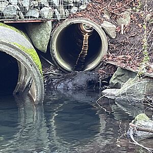
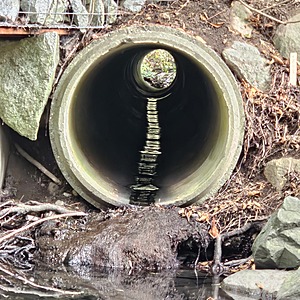
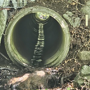
location of WAG-E-05 using zoom on web app. Wagg Creek passes under 19th in two culverts. on the south side of 19th St, the western culvert carries all the creek water at low flow. The culvert on the east connects to the 19th St storm drainage basin and enters in the middle of the street. At higher water flows the creek will also enter the eastern culvert and mix with the storm water before we can monitor it separately. The eastern storm pipe is concrete with an inside diameter of 0.54m. Do not monitor this site if you can see the creek flowing through both culverts on the north side of 19th St. Field measured GPS coordinates in NAD83 are -123.0798119, 49.32623161 in Long and Lat, or UTM 494,201E, 5,463,726N

- Site ID: WAG-E-05
- Lat: 49.3261149
- Lng: -123.0795979
- Waterbody Type: Unknown
- Timezone: America/Vancouver
Latest photos
View all photosTurb <14
Flows not done
Turbidity <14
Turbidity less than 14
Wetted Width 11 cm
Depth 2mm
Turbidity <14
Pipe inclination-2°
Wetted width 15cm
Wetted depth 5mm
No mixing of creek water with 19th Street storm water. I was measuring only storm drain water
Large crayfish and 2cm fish observed


