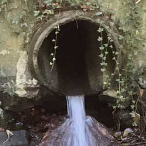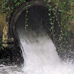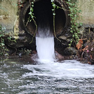
Stormwater pipe discharge
North Vancouver, British Columbia, Canada
corrected location of WAG-E-03 using zoom on web app. This is where a concrete storm pipe of 0.9m inside diameter surfaces and joins with Wagg Creek just downstream of a pedestrian bridge over the creek on the east side. A large plunge pool with large boulders forms a deep pool due to high energy discharge during storm. Field measured GPS coordinates in NAD83 are -123.0871740, 49.32245002 in Long and Lat, or UTM 493,665E, 5,463,306N

Location created by
Paul Lhotka
- Group: North Shore Streamkeepers Society : Wagg Creek Water Quality Monitoring Group
- Site ID: WAG-E-03
- Lat: 49.3223528
- Lng: -123.0872369
- Waterbody Type: Unknown
- Timezone: America/Vancouver
Latest photos
View all photosObservation tests summary
Water temperature
°C
21.1
Latest
14.6
Average
Alkalinity
mg/L
20
Latest
54
Average
Hardness
mg/L
0
Latest
33
Average
Chlorine
ppm
0.0
Latest
0.1
Average
Conductivity
μS/cm
75
Latest
225
Average
pH (0-14)
6.6
Latest
7.2
Average
Air temperature
°C
19.6
Latest
13.7
Average
Water depth
m
2.0
Latest
1.5
Average
Turbidity
NTU
32.0
Latest
15.2
Average
Water flow
l/sec
4.0
Latest
4.0
Average
Dissolved oxygen
%
9.0
Latest
9.0
Average
Dissolved oxygen
mg/L
9.0
Latest
8.3
Average
Ice On
Ice Off
- 2022-08-04


