Pearl River
Harrisville, Mississippi, United States
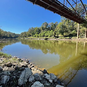
This testing site is on the eastern/Simpson County side of the river on Gatesville Rd., east of I-55 and north of MS Hwy 27. Parking can be had on the east side of the bridge, with a foot path on the downstream side of the bridge to a sandy riverbank along the paved road right-of-way. Depending on the river level, there will be a gentle current here.

- Group: Mississippi State University : Mississippi Water Stewards
- Site ID: PR-GTV
- Lat: 31.9963209
- Lng: -90.2239536
- Waterbody Type: River
- Timezone: America/Chicago
Latest photos
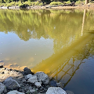
View all photosSome evidence of recent local fishing. The water had a brownish, green color. Some improvement in bacterial contamination from last month due to upstream sewage releases.
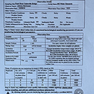
River level is elevated due to frequent rains over the past month. Bacteria levels fluctuate due to upstream sewage contamination, and caution is advised at this site with water contact.
River is several feet above normal level due to recent heavy rains upstream
River stage 9.6ft at Jackson and falling. This is approx. 4 ft higher than usual stage. River has been approx. 15 feet higher than present stage in the past week.
Observed a healthy school of very small minnows along the bank, and evidence of recent fishing activity. The water had low clarity and was greenish/brown in color with a film floating on the surface.
Evidence of recent bank fishing. River was up approx two feet since last check, and had a gentle current. Water clarity was a muddy appearance due to recent rains.
No issues during this observation and samples were taken where a gentle current was present. Water level is approx 3-4" lower than last week, and still has a finely, suspended sediment of unknown composition which affected water clarity. It continues to have a brownish, green color. Evidence of local fishing could be seen along the bank.
Water had a brownish-greenish appearance with finely suspended sediment, possibly algae. Evidence of recent bank fishing was noted at the site. A slow, gentle current is also noted.
River stage was 3.9ft in Jackson and steady, after falling several feet due to heavy rains in the past two weeks. Samples taken between the old and new bridges.


