Michipicoten River
Michipicoten, Ontario, Canada
River

- Group: Missanabie Cree First Nation : Dog Lake Head Waters Monitoring Program
- Site ID: MRM-WM-E
- Lat: 47.9222696
- Lng: -84.8045415
- Waterbody Type: River
- Timezone: UTC
Latest photos
View all photosFoul odour detected while traversing the hill from Hwy 17 down to the water. Possibly a carcass or something dead in the forest adjacent to the trail.
Water level is significantly lower than my last visit.
Lake Superior is approximately 3 feet lower since my last observation.
The water on Michipicoten River was moving relatively fast and exhibited a red hue due to its sandy bottom and morning sunlight.
Bald Eagle Sighting.
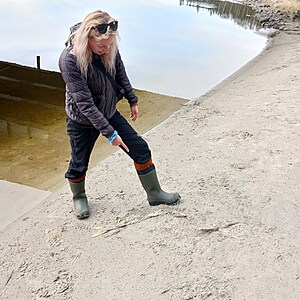
Various Salmon Carcasses along the sandy shores, indicating the eagle has been feeding well.
See pictures for salmon carcass size comparison.
5 Salmon carcasses total.
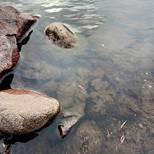
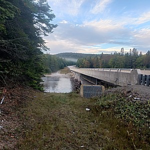
Algae specimen that has encapsulated some of the rock beneath the Hwy 17 Bridge cannot be identified. Uncertain whether the brown clotty sludge is algae or another species. To be further investigated at this site next visit and different seasonal intervals.
Bridge maintenance requires additional aggregate to prevent further erosion cause by the bridge drain system. Extreme weather events or spring runoff can catalyze this erosion process.
Did conduct secchi measurement nor measure water depth.
Entered by T.Hourtovenko, from results that were obtained by T. Sullivan (previous director of Land & Resources)
Suspect that ph strips were expired as results obtained by T. Sullivan are not consistent with recent results and certain strip containers were found to be expired during inventory process.


