Stream at junction of Polsted Lane and Withies Lane
Farncombe, Surrey, United Kingdom
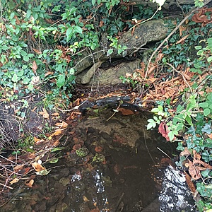
The point beyond which two streams meet on the other side of the road. Water is moving. What appear to be sand bags are located on one bank of the stream. Maximum depth 6-9".

- Group: River Wey Trust: ZERO Guildford Hub
- Lat: 51.2141863
- Lng: -0.6214351
- Waterbody Type: Stream
- Timezone: Europe/London
Latest photos
View all photosBranches in water and some overhanging plants
There has been substantial forestry work/logging recently in the area (see photos). It will be interesting to see whether this has an impact on water quality going forward.
The bank sides of a stream that feeds into the Withies/Polsted stream, on the other side of the road, has been cleared.
Leaves have dammed up the stream to some degree but the water is still flowing to the exit points
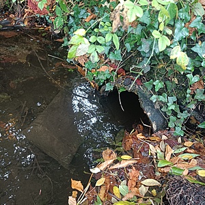
The water no longer appears to exit into the ditch (blocked by tree base/root) and instead leaves via the pipe which takes water to Withies Pond
Withies Pub Pond quite full so the pipe may be allowing water through from the stream
Removed broken branch to gain access for water sampling. Smaller branches remain in the stream. Yesterday was very wet in Guildford - persistent rain.
Some natural debris - sticks on side of stream bank. Sandy central stream bottom with some accumulation on the side where the pipe is located (drains to the pond near The Withies Pub?)
Water level was high.
A fair bit of natural debris has started to collect. The exit point (from the meeting point of the two streams where I test) is clogging up. I noticed that the pond by The Withies Pubs has refilled. There is a pipe, at the test location, that in theory takes water down to the pond but I heard previously that this had become blocked. A passerby today said that there might be other ditches that feed into the pond.


